



East Kazakhstan: Between steppe and snow-capped peaks
We take you on our incredible three weeks journey through East Kazakhstan from Oskemen in the West to the Yazovoe Lake in the East.
For almost ten years now, we have been travelling independently through Kazakhstan. Our goal was never simply to visit as many sights as possible. Rather, we wanted to discover the beauty, enormous geographical diversity and cultural uniqueness of this vast country – and, above all, explore its tourism potential, which is still largely unknown outside Central Asia. We have been sharing our impressions for many years through our online project INFOSHYMKENT. We introduced numerous readers around the world to a country that many of them knew little about or associated with misconceptions. And we also made some multimedia presentations in front of an audience in different German cities to show with our photos and Kazakh music the beauty and diversity of Kazakhstan. And time and again, we have seen how surprised our audiences were by Kazakhstan’s geographical diversity, hospitality and rich history. And we want to continue to ignite the passion and interest of people worldwide for Central Asia’s largest country.
In recent years, we had already explored the southern part of the country, particularly the regions around Almaty and – of course – Shymkent, quite extensively. The national parks and nature reserves of Eastern Kazakhstan, however, had long remained a blank spot on our map. Yet these places, with their magnificent mountains, crystal-clear lakes and fascinating history, are among the most impressive landscapes the country has to offer.
One particular photograph of this region stayed with us. Kazakh photographer Farhat Kabdykairov had photographed the snow-covered Muztau, also known as Belukha, from the remote Yazovoe Lake, also known as Karakol. The image awakened in us the dream of visiting this place ourselves one day. This summer, that dream finally came true. For three weeks, we travelled through Eastern Kazakhstan – in search of spectacular landscapes, fascinating stories and new insights into a region that is still considered a hidden gem even among many travellers to Kazakhstan.
Oskemen
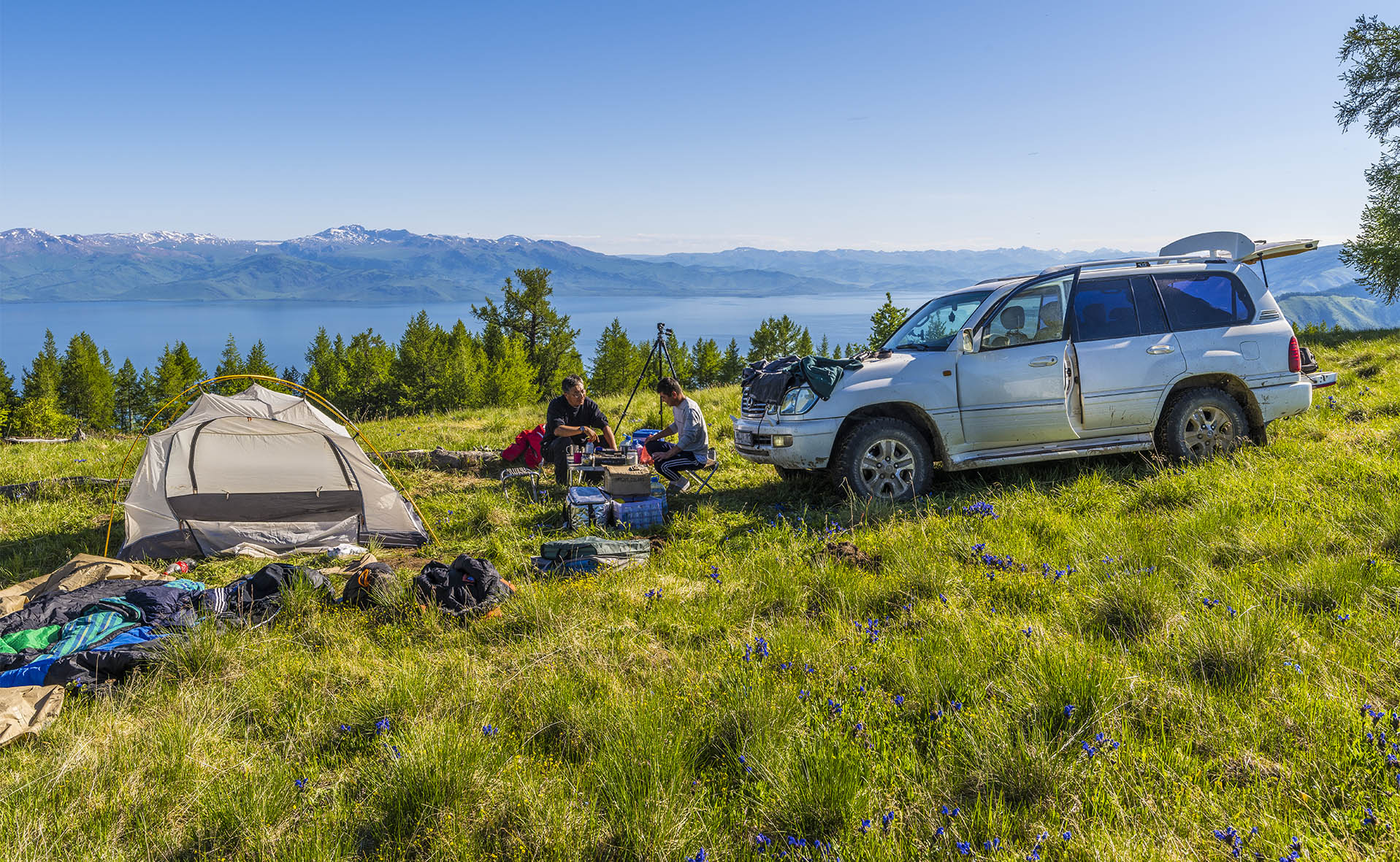
We began our journey in the Czech capital Prague, taking a direct flight operated by the Kazakh airline SCAT to Kazakhstan. After a pleasant flight and a short stopover in Kazakhstan’s capital Astana, we quickly continued on to East Kazakhstan. Our starting point was the city of Oskemen (also known as Ust-Kamenogorsk), the capital of the region. To recover somewhat from the three-hour jet lag between Kazakhstan and Germany and stretch our legs after the long flight, we strolled through the two shady and lush green parks named after Qasim Qaysenov and Zhambyl Zhabayuly. Along the way, we also admired the numerous colourful brick and wooden houses dating from the 18th and 19th centuries.

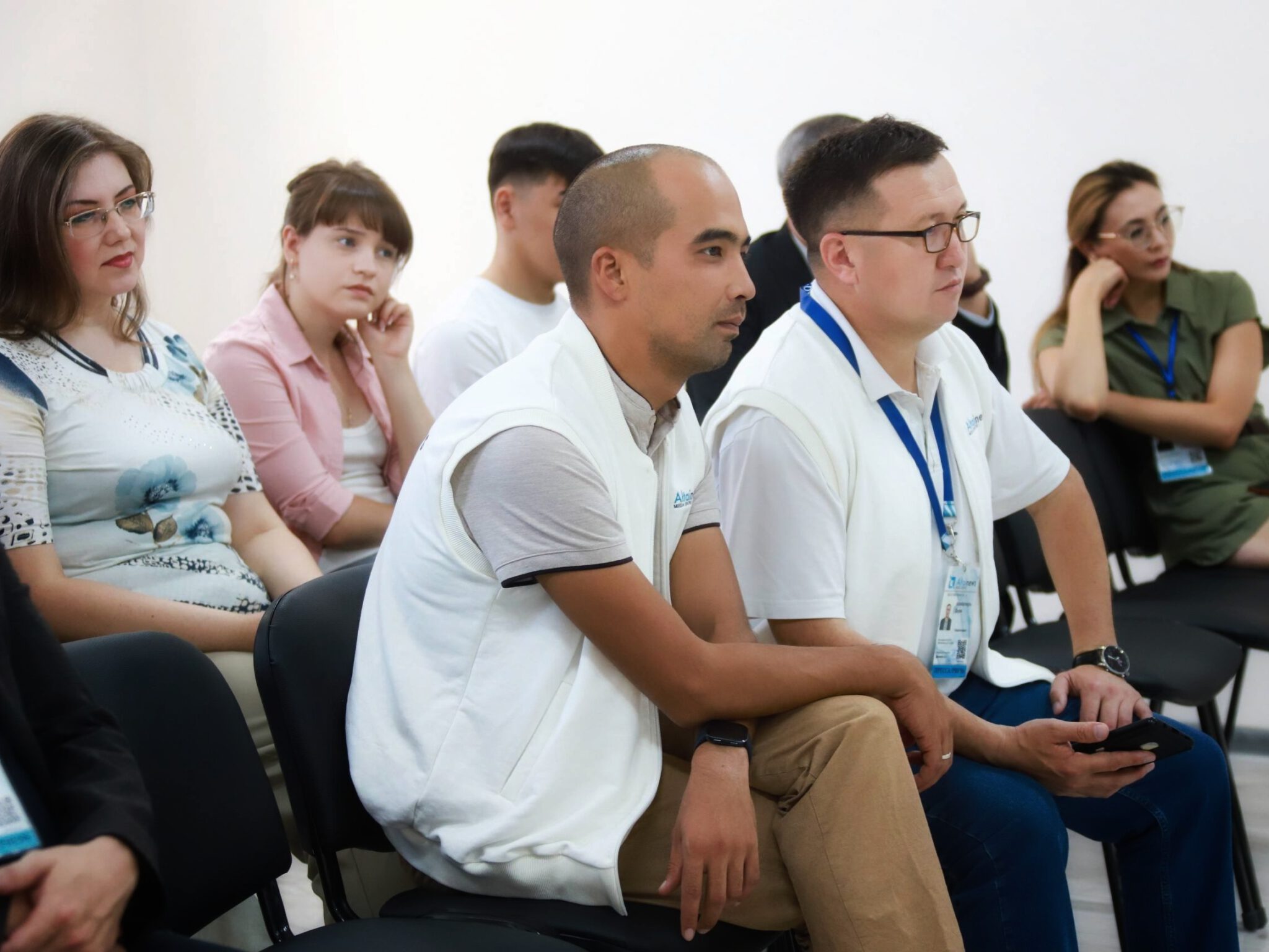
The following day, however, a full programme of welcoming events awaited us. Arseniy Dyusenov, head of the media organisation Altai News, had invited us to his office for interviews and, in the process, gave us an interesting insight into the modern media facilities, where we gained an impression of the regional reporting of East Kazakhstan. At the end we signed an MoU to collaborate in future projects. Afterwards, we were warmly welcomed at the Akimat of Eastern Kazakhstan. Vice-Akim Yerbol Nurgaliyev personally greeted us and wished us a pleasant, safe and memorable journey through his home region. The warm words of Vice-Akim Nurgaliyev and Arseniy Dyusenov once again reflected the famous Kazakh hospitality that would accompany us throughout our journey.
The E40 Highway
We first left Oskemen heading east and followed the final kilometres of the E40 European route, one of Europe’s longest long-distance roads, to Ridder. Few highways connect so many famous cultural and industrial centres. Stretching for more than 8,640 kilometres, it connects Europe with Central Asia, running from the port of Calais on the Atlantic Ocean through Brussels, Aachen, Cologne, Erfurt, Dresden, Kraków, Kyiv, Volgograd, Astrakhan, Atyrau, Samarkand, Tashkent, Almaty and Oskemen, before reaching the mining town of Ridder in the Western Altai.
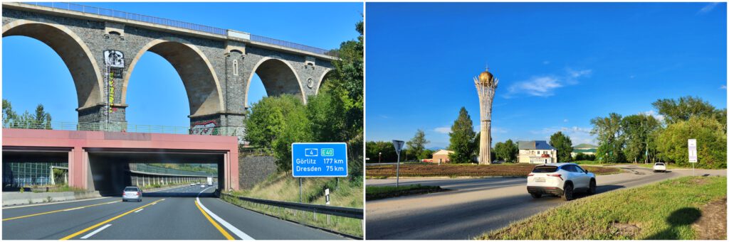
This road also connects countless people – a beautiful thought, because our hometowns, Shymkent and Chemnitz, are both located along the E40. In a sense, we grew up along the same road, even though our hometowns are thousands of kilometres apart. It was a little disappointing that, at the Kazakh end of the E40 – at the roundabout in Ridder – we could not find any sign referring to this long-distance route. Surely many tourists would love to take a proud photograph of themselves in front of a road sign representing this remarkable connection between Europe and Central Asia.
Ridder
The mining town of Ridder, which may perhaps develop into a hiking destination in the near future, owes its name to the town’s founder, the German officer Philipp Ridder. He served the German-born Empress of the Russian Empire Catherine the Great and was commissioned to search for mineral resources in the Altai. In 1786, he successfully discovered significant deposits.

In 1829, the famous German explorer Alexander von Humboldt also visited the area. His companion Christian Gottfried Ehrenberg even made a drawing of the mountain panorama around Ridder. For us, it is fascinating to encounter the shared Kazakh-German history in so many places throughout Eastern Kazakhstan.
Western Altai
Ridder was to become our first base for an excursion into the wilderness of Kazakhstan. One of our personal highlights had been the opportunity to visit Stone Fairy Tale (Kazakh: Tas ertegisi) in Western Altai National Park. Unfortunately, access was denied to us because of the increased risk of forest fires.

Instead, we embarked on an adventurous jeep tour into the Ivanovsky Mountains to the Radon Lake. Rarely have we experienced a place where the colours of nature harmonise so intensely. The deep, glowing turquoise of the lake, greyish-red rocks, snow-white mountain peaks and lush green alpine meadows filled with colourful, partly endemic mountain flowers created a landscape that seemed almost unreal to us.
The Archaeological Site of Ak-Baur
No less impressive was the archaeological site of Ak-Baur, which we visited on our way to the Sibiny Lakes. Ak-Baur is one of the oldest archaeological sites in Kazakhstan. The Bronze Age solar observatory and the partially excavated early Saka settlements from the Iron Age provide an impressive insight into the remarkable knowledge and craftsmanship possessed by the ancestors of today’s Kazakhs thousands of years ago.

The mystical atmosphere created by the granite rocks rising from the green steppe and the pyramid-shaped Mount Sorokina made it easy to understand why Ak-Baur is still regarded by many as a spiritual place.
The Sibiny Lakes
After so much history, the nearby Sibiny Lakes offered the perfect opportunity to relax and unwind. The cool water of the mountain lakes provided a welcome refreshment, while from the shore we enjoyed an impressive view across the clear mountain water towards the massive granite cliffs of the Kalba Mountains of the Altai.
Abylaikit Monastery
With renewed energy, we hiked the few kilometres to the foundations of the former Buddhist Abylaikit Monastery. As early as 1771, Nikita Sokolov, the assistant of the famous German naturalist Peter Simon Pallas visited this remote monastery of the Dzungars, which had already been abandoned by that time but was still structurally intact and he found some scripts in Tibetian language.

Sokolov made even a drawing of the beautifully situated complex and later described it extensively in the travel accounts of Pallas. Today, unfortunately, only the preserved foundations allow us to imagine the scale of this sacred building.
The Bukhtarma Reservoir
We continued south by rental car, following the Kalba Mountains, to reach the gigantic Bukhtarma Reservoir, which divides Eastern Kazakhstan almost into two parts. Its nickname, the sea, aptly describes its immense size. In the past, this sea could be crossed by ferry in summer and by driving across the ice in winter. For the past two years, however, a new bridge has significantly shortened the journey.

The gigantic 1.3-kilometre-long bridge is now the longest bridge in Kazakhstan and has become a proud symbol of the engineering achievements of modern Kazakhstan. We were certainly pleased with the quick crossing, even though, as relaxed travellers, we could not help but miss the former ferry ride, which had almost had the character of a small, leisurely cruise.
A Feeling of Freedom
After spending the night in the small town of Kurschim and visiting the colourful and impressive rock formations of Kiin Kerish, which reminded us of the American Badlands, we continued for an impressive 150 kilometres by European standards along an almost endless, nearly straight road towards the Chinese border. As chance would have it, this was also Dombra Day, and the Kazakh radio played the best dombra pieces nonstop. Listening to the sounds of this famous two-stringed instrument, we felt like a rider trotting towards the horizon. The vastness of the Kazakh landscape creates a truly overwhelming feeling of freedom. Perhaps this feeling best reflects the meaning of the Kazakh word Qazaq, meaning free person.
The Dunes of Aq-Qum
Shortly before the border, after the long, partly green and partly barren flat steppe, a huge sea of golden sand dunes gradually emerged on the horizon – at first appearing like a mirage, then becoming increasingly clear. These are the sand dunes of the Aq-Qum Desert. The desert forms a natural border between Kazakhstan and China.

After climbing the Marble Pass by car, we were able to admire this natural wonder from another perspective before descending into the alpine landscape surrounding Lake Markakol.
Lake Markakol
Lake Markakol seems almost like another world. Absolute tranquillity, crystal-clear mountain air and a vast lake surrounded by partly snow-covered mountains create a unique atmosphere.

For ornithologists, the area is a true paradise, as numerous rare waterbirds and birds of prey find a protected habitat here. And tourists like us also had plenty to enjoy. At a small boat landing, we could simply relax, recover from the long journey and enjoy the mountain panorama reflected like a mirror in the shallow, crystal-clear lake.
The Old Austrian Road
A piece of European history can also be found in this remote region. The so-called Old Austrian Road, known locally in Kazakhstan as Irek, was built during the First World War by Austro-Hungarian prisoners of war under extremely difficult conditions. It leads from Katon-Karagai through a beautiful mountain landscape to Lake Markakol.

Even today, however, the unpaved road is difficult to drive. Our rental car was not equipped for a route with deep water crossings and rough, deeply rutted sections. Nevertheless, we had the opportunity to get a first impression of this historic road from both approaches – from Lake Markakol and from Katon-Karagai.
Perhaps one day this historic route will be improved sufficiently to allow even small cars to travel it, opening up the region to more visitors.
Altaifest in Katon-Karagai
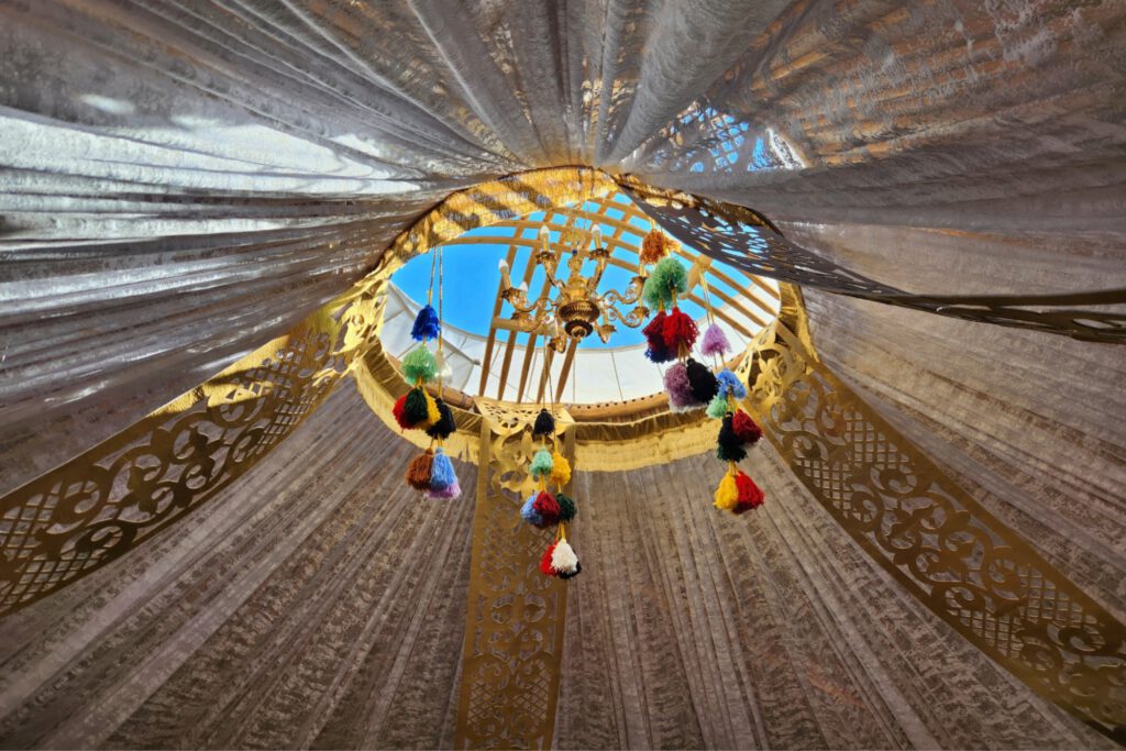
From the tranquillity of Markakol, we moved on to the otherwise peaceful village of Katon-Karagai, with its population of around 3,000. During the Altaifest ethnic festival, 50,000 guests from near and far were welcomed here. In the afternoon, visitors were entertained with traditional equestrian sports such as Kokpar – a kind of football played on horseback – and Kunan Baige, an endurance race involving young jockeys and young horses. There were also magnificent yet traditionally furnished yurts representing the regions of Eastern Kazakhstan, as well as poetry competitions. After the sun had disappeared behind the mountains, the gala concert began, featuring musicians from Turkic countries – from Hungary and Azerbaijan all the way to Mongolia. A colourful show celebrated the shared culture of the Altai and the Turkic peoples late into the night.

The highlight and finale was the performance by the internationally renowned Kazakh singer Dimash Kudaibergen. From our perspective, the festival demonstrated impressively how a shared cultural heritage can transcend borders and successfully promote understanding between peoples.
The Kurgans of Berel
After plenty of music and conversations, we continued at a more leisurely pace towards the famous Kurgans of Berel. A well-equipped museum presents the exceptionally well-preserved royal burial sites of the Saka people in traditional log buildings and a reconstructed kurgan. They are among the most important archaeological sites in Central Asia.
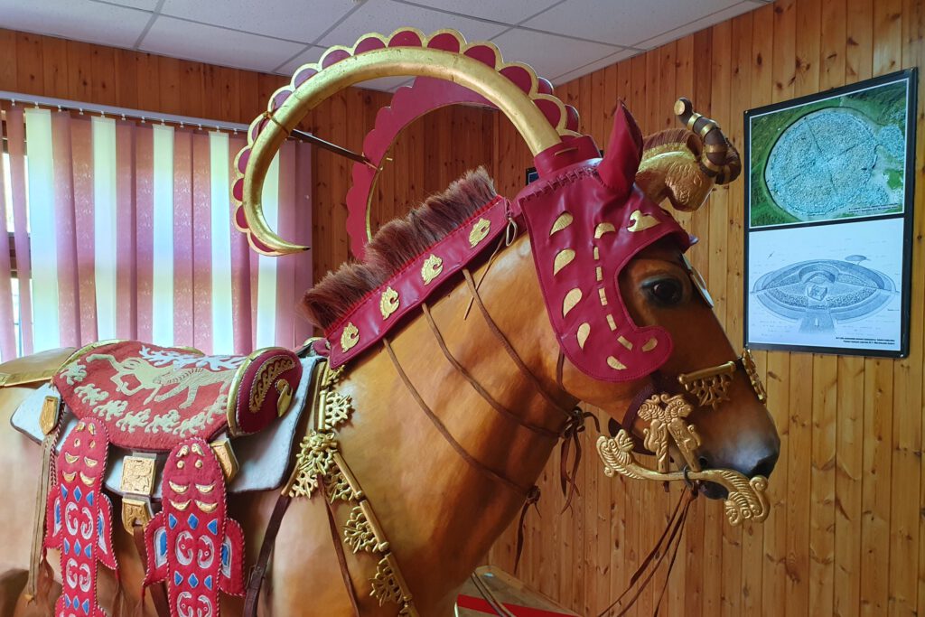
A German also played an important role here more than 175 years ago. The German Turkologist Wilhelm Radloff carried out the first scientific excavations in the valley of the White Berel River in 1865.
Yazovoe Lake
We had originally planned to cover the final section of our journey on horseback. Unfortunately, for organisational reasons, the horses had to be exchanged for a nostalgic iron horse – a UAZ-469. Along a beautiful track, it eventually took us to the crowning finale of our journey: the blue-shimmering Yazovoe Lake. There, we were rewarded with one of the most beautiful views Kazakhstan has to offer – a view we had been dreaming about for a long time:
A blue lake surrounded by lush green meadows and endless coniferous forests – and in the distance, majestic Belukha towered with its twin peaks beneath the deep blue sky of Kazakhstan. At 4,506 metres, the mountain is the highest peak of the Altai Mountains.

We were fortunate enough to enjoy this breathtaking view until sunset. In the warm evening light, the snow-covered slopes glowed golden and were reflected in the waters of Yazovoe Lake. This magnificent sight brought an unforgettable conclusion to our three-week journey and fulfilled a long-held dream.
Conclusion
Eastern Kazakhstan deeply impressed us with its geographical diversity, its fascinating Kazakh history and the warmth of the people we met along the way.

Among ancient sacred sites, stories of explorers, enormous snow-covered mountains and almost untouched wilderness, we discovered a region that remains a hidden gem even for experienced travellers. Anyone wishing to experience the more authentic side of Kazakhstan will find in Eastern Kazakhstan vast landscapes full of colourful contrasts, freedom and wonderful stories.